Powerful Supercell Devastates Greensburg, Kansas
Last night at around 10:00 PM, I was watching a severe weather outbreak across parts of Oklahoma, Kansas, and Nebraska when I noticed a powerful "classic" supercell move through Greensburg, Kansas about 135 miles west of Wichita, Kansas. By definition, a supercell is a severe thunderstorm with a deep, persistent, rotating updraft. They can produce a range of weather from damaging winds to hail to heavy rain to tornadoes. The one that hit Greensburg produced a powerful tornado which destroyed over 75% of the city according to Fox News. As of 3:45 PM Saturday, seven people have been killed by this storm. Here are some radar images of the supercell as well as a sketch of the structure of a supercell.

Base Reflectivity Radar image showing the well-defined "hook echo" to the northeast of Greensburg. The white pixels are likely large hailstones being detected by radar. The tornado is inside the green pixels inside the "hook".
 Storm Relative Motion image showing a "couplet" northeast of Greensburg. Green and blue colors are storm areas moving towards the radar while red and yellow colors are storm areas moving away from the radar. Therefore, yellow against blue indicates that the areas are moving towards each other and shows us where the mesocyclone is located.
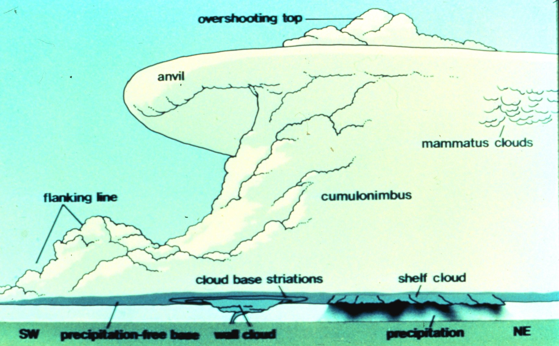 Diagram of a classic supercell thunderstorm (source: Wikipedia)
posted by Jason's Weather Center @ 3:39 PM
2 Comments
![]()
![]()

2 Comments:
Howdy everyone, I just signed up on this delightful forum and wanted to say hello there! Have a incredible day!
Good fill someone in on and this enter helped me alot in my college assignement. Thank you as your information.
Post a Comment
Subscribe to Post Comments [Atom]
<< Home